
Disaster UAS Support
Close the communication and documentation gaps in disasters with rapid, actionable UAS intelligence.
-
Preparedness isn't theoretical. We offer concrete, data-driven missions that directly improves outcomes in the later phases. The quality of post-event response depends heavily on what was done beforehand.
-
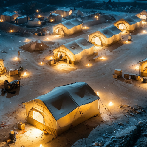
When lives, timelines, and decisions are moving fast - dedicated UAS support gives leaders the eyes they otherwise wouldn't have. Increase safety, reduce confusion and speed up life-saving action.
-
Recovery is all about accuracy, documentation and compassion. The long tail of disaster recovery requires meticulous data needed for claims, FEMA filings and long-term rebuilding oversight.
Our mission is to stand as a trusted, pre‑positioned partner that expands the capabilities of public agencies before, during, and after disasters.
We deliver surge capacity, specialized expertise, and rapid intelligence through formalized partnerships that remove delays and strengthen readiness. By filling the structural gaps agencies cannot staff internally, we act as a true force multiplier—helping communities respond faster, recover stronger, and stay resilient.
LIVE stream
Real-time aerial feeds powered by Starlink provide global connectivity—even in disaster zones. Emergency managers, responders, and command centers gain instant visual access to unfolding events, enabling faster decisions and coordinated action.

Preparedness
-

Baseline Imagery
Establishing a visual record before disruption is key. Our aerial property and asset documentation provide accurate, timestamped imagery that supports planning, risk assessment, and post-event comparisons.
Supports:
- Emergency management & continuity planners
- Property managers & large‑asset owners
- Insurance carriers & risk assessors
-

TRAINING SUPPORT
Our aerial footage enhances training scenarios for emergency response, safety drills, and operational planning—providing real-world context without real-world risk.
Supports:
- Fire rescue, law enforcement & USAR teams
- Industrial safety & EHS departments
- Campus, port & airport emergency operations
-

Security Vulnerability Scan
We identify gaps in perimeter security, access control, and visibility using aerial perspectives. These scans support physical security audits and proactive mitigation planning.
Supports:
- Corporate & campus security directors
- Critical infrastructure operators
- Government facilities & municipal campuses
response
-
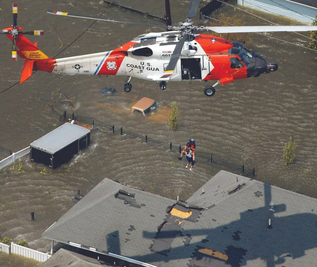
Search & Rescue Augmentation
In partnership with the nation’s top civilian SAR organization, who deploy air assets and USAF Pararescue operators to deliver life-saving support. Our drone integration enhances coordination, speed, and survivability in high-risk environments.
Supports:
- Sheriff’s offices & law enforcement
- Fire rescue & SAR task forces
- Emergency management agencies
-
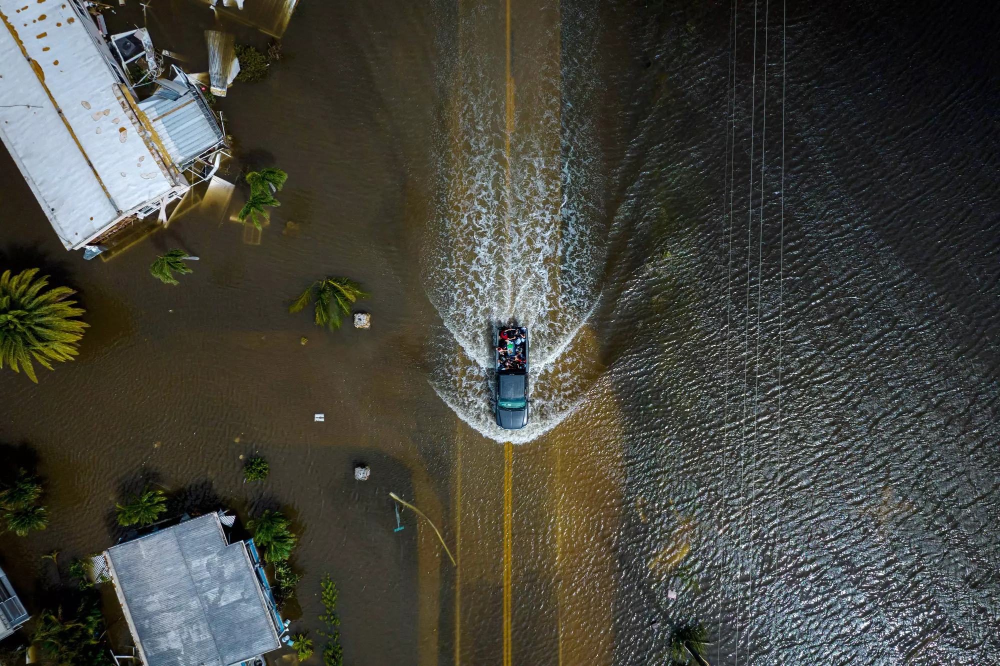
Access & Mobility recon
Real‑time streaming and mapping of blocked roads, debris, flooding, and chokepoints. Providing immediate situation awareness and clarity to the teams that need to move resources efficiently.
Supports:
- Logistics, EMS & public safety
- Utilities & public works
- Emergency operations centers
-
Crowd & Traffic monitoring
Live aerial visibility over shelters, public movement, traffic flow, and evacuation routes. We help agencies spot bottlenecks, unsafe conditions, and stranded individuals so they can adjust operations in real time.
Supports:
- Emergency management & shelter operations
- Law enforcement & traffic control units
- Event, campus & municipal operations teams
Recovery
-
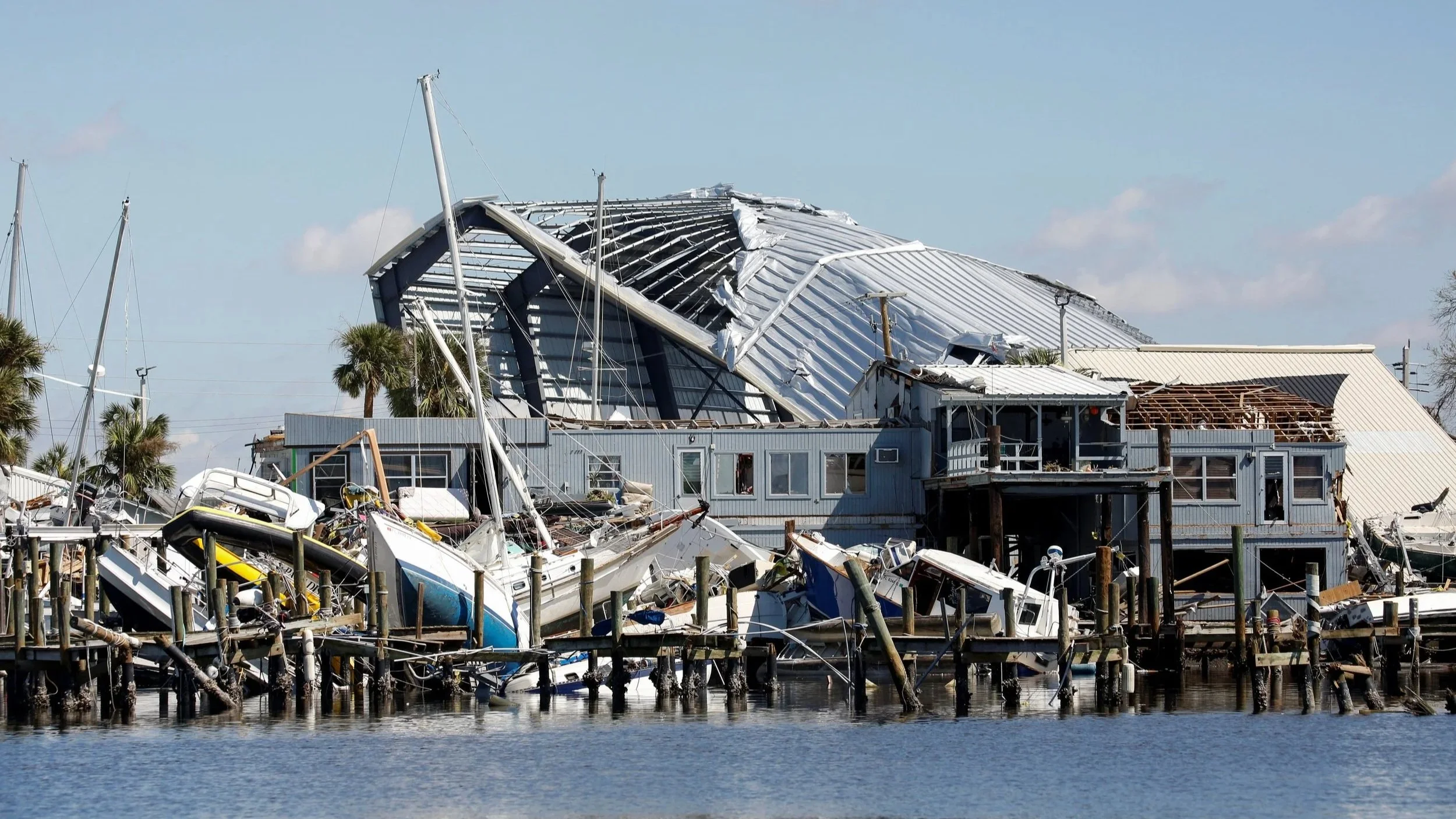
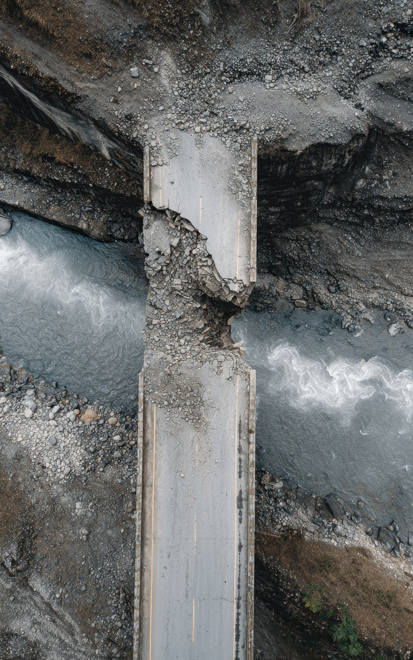
Damage Documentation
High-resolution drone imagery & video provides a clear, timestamped record of damage. This documentation supports insurance filings, legal assessments, and post-disaster audits with reliable visual proof.
Supports:
- Insurance carriers & adjusters
- Public works & infrastructure owners
- Property managers & commercial asset groups
-

Comparative Analysis
Before-and-after imagery helps quantify damage and guide response. Integrated with our pre-disaster documentation, this data becomes a powerful tool for validating impact and accelerating recovery decisions.
Supports:
- Emergency management & recovery planners
- Insurance & legal assessment teams
- Municipal & state infrastructure agencies
-
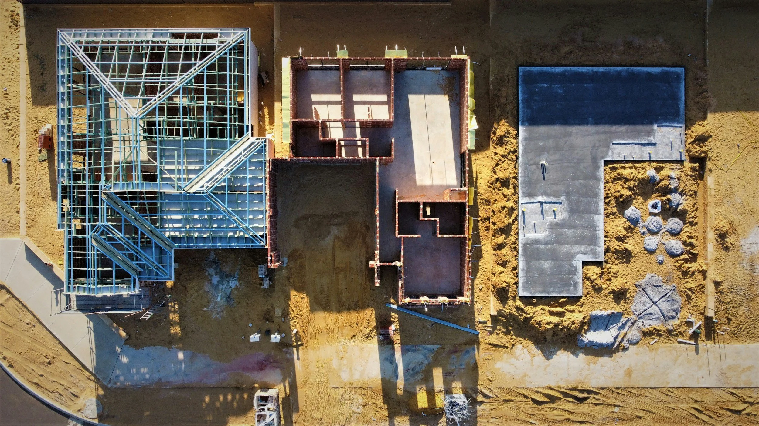
Progress Monitoring
Recurring drone flights track progress with consistent aerial updates. Our imagery helps confirm timelines, document changes, and ensure transparency.
Supports:
- Construction & engineering firms
- Project managers & oversight teams
- Insurers verifying timelines & deliverables